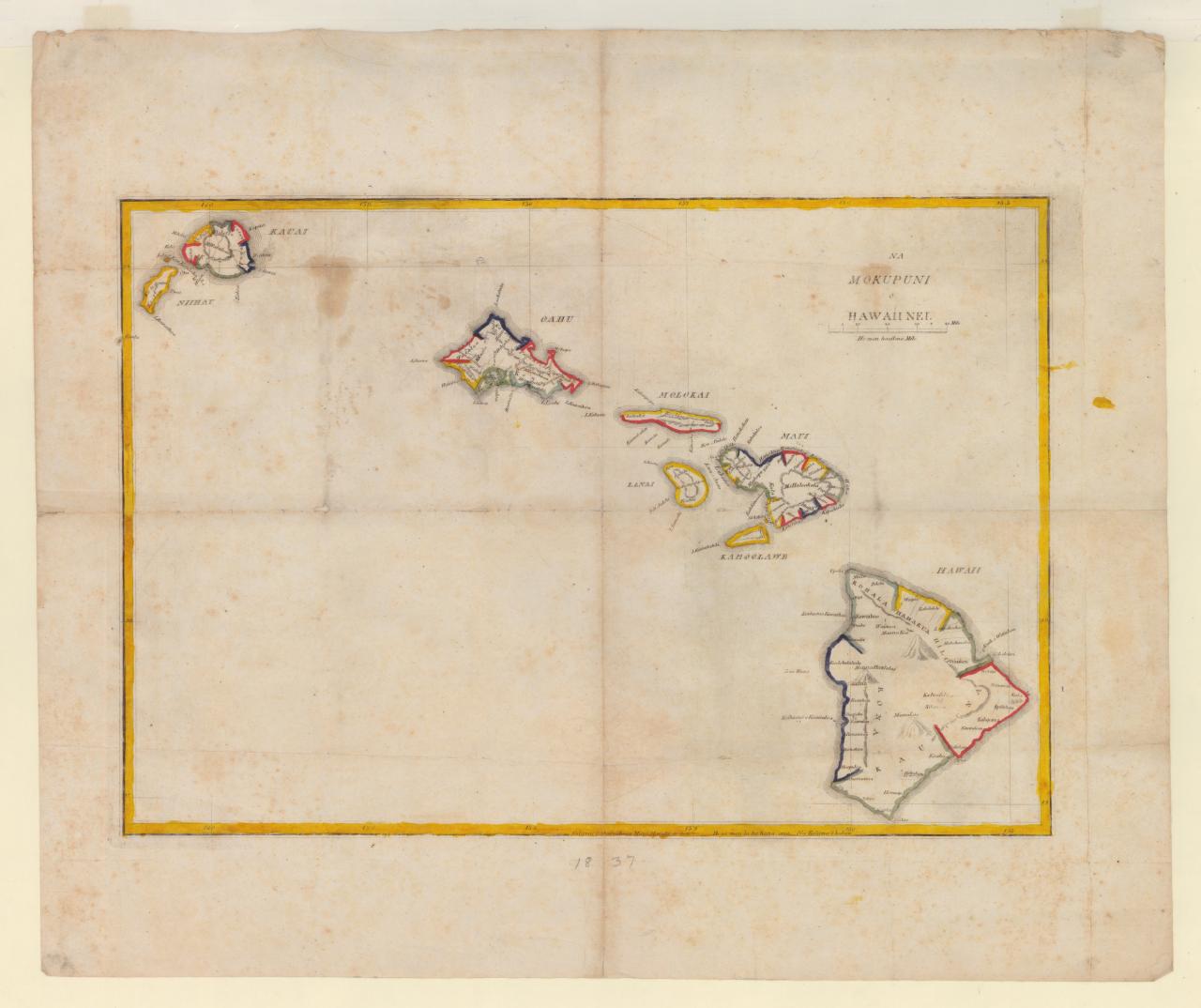
Students at Lahainaluna Seminary produced dozens of maps, both local and global. This map of the Hawaiian Islands is divided into color-coded districts. The engraver, Simona Petero Kalama, grew up in Lahaina. He entered the Lahainaluna Seminary around 1834, engraved this map in 26 days of work in 1837, and remained a student until 1839. Eventually, Kalama became a land surveyor, landowner, and held government positions.
English translation of title: High School Lahainaluna March 9, 1837. 26 days of work. Engraved by Kalama.
Publication / Creation Year
1837